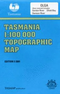
The 1:100 000 topographic map series from TasMap covers the Olga area.
This map includes the following details:
- Both man-made and natural features
- Roads are symbolized to reflect their surface, accessibility and importance to the State network
- Distances between major road intersections and the portrayal of selected addressed buildings aid vehicle navigation
- All major reserved land and foot tracks are clearly defined
- The shape of the ground is depicted by using a combination of contours (at a 20 metre vertical interval) and hillshading
- Both forested and non-forested areas


